Table of Contents
Groundwater Elevation
How to create a groundwater elevation data stream.
Table of Contents
Calculate the true water level referenced to elevation. Typically used for depth-to-groundwater calculations in civil and geotechnical applications, groundwater elevation is a basic conversion for water level data: it calculates the depth relative to the well elevation by subtracting the install depth from the well elevation.
Groundwater Elevation = (Well Elevation − Install Depth) + Head
- Well Elevation is typically the top-of-casing (TOC) elevation from sea level.
- Install Depth is the sensor installation depth from a point of reference, typically a wellhead.
- Head is the sensor-measured water level.
Supported sensors
Groundwater elevation can be calculated from any water level measurement.
Recommended sensors
- HYDROS 21
- CTD
- CTD-5
- CTD-10
Create a Groundwater Elevation model
- On the Data page, click New Data.
- Select Groundwater Elevation as the type.
- Select one or more water level sources.
- Edit the data stream color.
- Edit the data stream name.
- The sensor Position is the default value for the install depth. Edit the Height/Depth, or enter a value if none is present.
- Enter a value for the Top of Casing / Well Elevation.
- Select Save, then Create to finish.
The new data stream(s) will now appear in your data list.
Groundwater elevation

Groundwater elevation edit
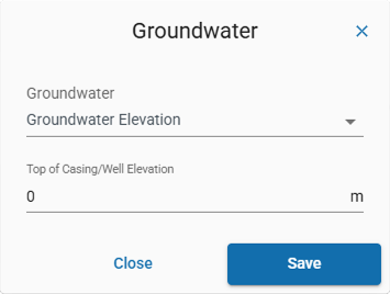
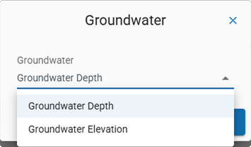
Groundwater variants

How-To-Video
How did we do?
Groundwater Depth
Growing Degree Days / Hours